1813 Atlas For School Ancient and Modern Maps Rev J Goldsmith Folding Map Scarce
Click here to see our other books!
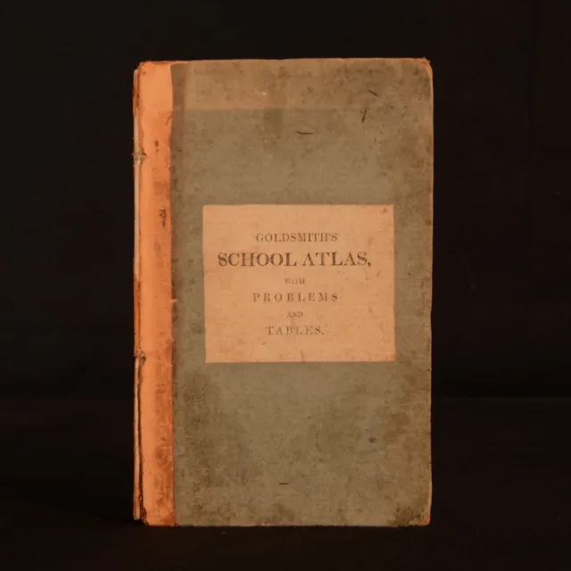
An Atlas For School, Containing Ancient and Modern maps, Drawn From The Best Authorities ; Prefaced by Twenty-Four Problems On Maps, And By A Copious Table of Latitudes and Longitudes
Rev J Goldsmith
1813
Richard Phillips : London
9.5" by 6"
xxxvi, 17pp [15 unpaginated maps]
An Atlas For School, Containing Ancient and Modern maps, Drawn From The Best Authorities ; Prefaced by Twenty-Four Problems On Maps, And By A Copious Table of Latitudes and Longitudes
Rev J Goldsmith
1813
Richard Phillips : London
9.5" by 6"
xxxvi, 17pp [15 unpaginated maps]
1813
Richard Phillips : London
9.5" by 6"
xxxvi, 17pp [15 unpaginated maps]
9.5" by 6"
xxxvi, 17pp [15 unpaginated maps]
SUMMARY
A very scarce works of cartography profusely illustrated with folding maps.
Folding Maps,Illustrated,Publishers' Original Binding
Overall Condition: Very Good
This book weighs 0.5 KG when packed
UK Postage: £ 3.99
US Postage: £ 15.99
EU Postage: £ 13.99
European Postage: £ 14.99
Asia Postage: £ 18.99
Worldwide Postage: £ 19.99
DESCRIPTION
A very scarce work.
By the author of several geographical and educational works, the Rev. J. Goldsmith.
This volume includes a chapter defining map related terms such scale, longitude and latitudes, a chapter titled problems of maps, a table of latitudes and longitude of notable places, followed by a series of folding maps.
In the chapter Problems on Maps, the author provided a series of problems that teachers may set their students. Very much designed as an educational tool, Goldsmith intended this works to be used as a study aid for both teacher and student.
There are 15 maps in total, collated complete. With two world maps one being the Stereographic projection and the other the Mercator's Projection, and the remaining featuring the following subjects: Europe, Asia, Africa, North America, South America, the West Indies, Hindostan, England, Scotland, Ireland, the Roman World, Ancient Greece and Palestine.
Previous owners ink inscription to the front and rear endpapers.
The maps themselves are in very good condition.
CONDITION
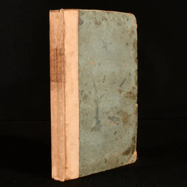
In a quarter calf binding, with paper covered boards. Externally rubbed with loss to the spine. Bumping to the extremities. light sunnign to the head of the front board. Large crack to the centre of the backstrip. Cut makrs to the rear board, resulting in a small amount of loss. Front hinge is strained, held by cords. Previous owners ink inscription to the front and rear endpapers. Light offsetting towards the front and rear endpapers and pastedowns, towards the hinges. Internally generally firmly bound, strained in places. Pages are generally clean with the odd mark. The map are in very good condition, with Light offsetting the reverse of several maps, with the extremities lightly age toned.
Overall Condition: Very Good
GLOSSARY OF TERMS
Overall Condition
(Dustwrapper condition rating is shown after that for the book itself, where a dustwrapper is present)
Fine - Very well preserved copy showing very little wear
Very Good Indeed - Only one or two minor faults, really a very attractive copy
Very Good - Quite a wide term meaning no major faults but probably several smaller ones
often expected given the age of the book, but still a respectable copy
Good - Meaning not very good. Some more serious faults as will
be described in the condition report under 'condition'
Good Only - Meaning one or more faults that could really do with repair
Fair - As with good only above but with other faults
leaving a compromised copy even after repair
Poor - Really bad and possibly seriously incomplete.
We only sell books in this condition where their rarity or value makes them
attractive none the less. Major defects will be described.
GUARANTEE
We offer a full money back guarantee on our descriptions.
Please ask for details and conditions. We prefer PAYPAL.
If you pay via PAYPAL we will post the item off the same or the next working day with the postage you have selected.
Please note we cannot accept USD cheques
- Sujet: Dictionaries & Reference
- Reliure: Leather
- Auteur: Rev J Goldsmith
- Lieu de publication: London
- Nom de publication: Richard Phillips
- Date de publication: 1813
- Caractéristiques spéciales: None
- Langue: English
- Poids: 0.5000
PicClick Insights - 1813 Atlas For School Ancient and Modern Maps Rev J Goldsmith Folding Map Scarce PicClick Exclusif
- Popularité - 0 personnes suivent la vente, 0.0 de nouvelles personnes suivent la vente par jour, 1.824 days for sale on eBay. 0 vendu, 1 disponible.
- Meilleur Prix -
- Vendeur - 19.806+ articles vendu. 0% évaluations négative. Top-Rated Plus! Vendeur Top Fiabilité, la politique de retour de 30 jours, les navires en 1 jour ouvrable avec le suivi.
Les Gens ont Aussi Aimé PicClick Exclusif

Kieper’s Grosser Handatlas / 1896 / Very Scarce Atlas / Beautiful Cards
EUR 400,00 0 Enchères 4d 7h
Survey of India - MAP CATALOGUE - 1931 - Calcutta - Atlas - Asia - RARE Maps
EUR 68,00 0 Enchères 9d 12h
1813 Letters from the Levant John Galt First Edition Very Scarce
EUR 514,21 Achat immédiat 20d 5h
1789 The Goldsmith's Repository W. J. Alldridge Folding Plate Scarce
EUR 419,28 Achat immédiat 20d 5h
Goldsmith.s History Of The Earth & Animated Nature. Animal Kingdom. Six Vol Set
EUR 322,19 Achat immédiat 17d 8h


